|
|
|
|

|
|
|
|
Fusiliers Arch, commemorating the Royal Dublin Fusiliers who died in the Boer War, which is the main entrance to St Stephen's Green, Dublin. |
|
|
|
|
|
|
|
|

|
|
|
|
St Stephen's Green, a park in Dublin. |
|
|
|
|
|
|
|
|

|
|
|
|
The wind plays with a water fountain in St Stephen's Green, Dublin. |
|
|
|
|
|
|
|
|
|
|
|
|
|

|
|
|
|
Temple Bar district, Dublin. |
|
|
|
|
|
|
|
|
|

|
|
|
|
Temple Bar district, Dublin. |
|
|
|
|
|
|
|
|

|
|
|
|
A small village in Wicklow County, south of Dublin. |
|
|
|
|
|
|
|
|

|
|
|
|
On our drive south from Dublin we passed many old ruins in farm fields, like this one. |
|
|
|
|
|
|
|
|

|
|
|
|
An old graveyard in a farm field, south of Dublin. |
|
|
|
|
|
|
|
|
|

|
|
|
|
South of Dublin we passed fields with sheep and stone walls. |
|
|
|
|
|
|
|
|
 in the British Isles. A very cold windy day!")
|
|
|
|
Wicklow county, the highest waterfall (122 metres) in the British Isles. A very cold windy day! |
|
|
|
|
|
|
|
|

|
|
|
|
Wicklow County waterfall. |
|
|
|
|
|
|
|
|
|
|
|

|
|
|
|
Brittas Bay, eastern coastline south of Dublin. Braving the cold for our traditional 'adventure photo'. |
|
|
|
|
|
|
|
|
|

|
|
|
|
Brittas Bay, sand blown by the wind skims across the beach. |
|
|
|
|
|
|
|
|
|
|
|

|
|
|
|
The Irish Sea pounds the coastline, south of Dublin. |
|
|
|
|
|
|
|
|

|
|
|
|
Town of Arklow, south of Dublin on the eastern coast. |
|
|
|
|
|
|
|
|
|

|
|
|
|
Arklow; standing in front of The Bridge Hotel, our accomodation on Sunday night. |
|
|
|
|
|
|
|
|
 tower, Wexford town.")
|
|
|
|
Selskar Abbey (founded in 1190) tower, Wexford town. |
|
|
|
|
|
|
|
|
|
|
|

|
|
|
|
Standing inside the remains of Selskar Abbey, Wexford. |
|
|
|
|
|
|
|
|

|
|
|
|
South of Arklow, Wexford County. |
|
|
|
|
|
|
|
|

|
|
|
|
Thatched-roof house, Kilmore Quay. |
|
|
|
|
|
|
|
|

|
|
|
|
Thatched-roof house, Kilmore Quay, a small rural fishing village. |
|
|
|
|
|
|
|
|
|
|

|
|
|
|
Joe in our hire car on the ferry from Ballyhack, Wicklow County to Passage East, Waterford County. |
|
|
|
|
|
|
|
|

|
|
|
|
Joe paying the ferry operator. |
|
|
|
|
|
|
|
|

|
|
|
|
Village of Ballyhack, with its castle, a 15th century tower house; from the car-ferry - Ballyhack to Passage East. |
|
|
|
|
|
|
|
|
|

|
|
|
|
The ferry approaches the village of Passage East, Waterford County. |
|
|
|
|
|
|
|
|

|
|
|
|
The main street in the village of Passage East, Waterford County. |
|
|
|
|
|
|
|
|
|
|
|

|
|
|
|
Jerpoint Abbey, stone carvings on a tombstone in the church. |
|
|
|
|
|
|
|
|

|
|
|
|
Jerpoint Abbey. The Abbey is among the finest of Ireland's medieval ecclesiastical ruins. |
|
|
|
|
|
|
|
|

|
|
|
|
Jerpoint Abbey. The Abbey may has started as a Benedictine foundation, but the Cistercian monks established themselves here in 1180. |
|
|
|
|
|
|
|
|

|
|
|
|
Jerpoint Abbey. The ruins are laid out according to a typical Cistercian plan; a church, Chapter house, kitchen, dormitory around a square cloister. |
|
|
|
|
|
|
|
|
|

|
|
|
|
Jerpoint Abbey. Most of the existing structure dates from 1180. |
|
|
|
|
|
|
|
|

|
|
|
|
The cloister of Jerpoint Abbey is decorated with interesting carvings. |
|
|
|
|
|
|
|
|

|
|
|
|
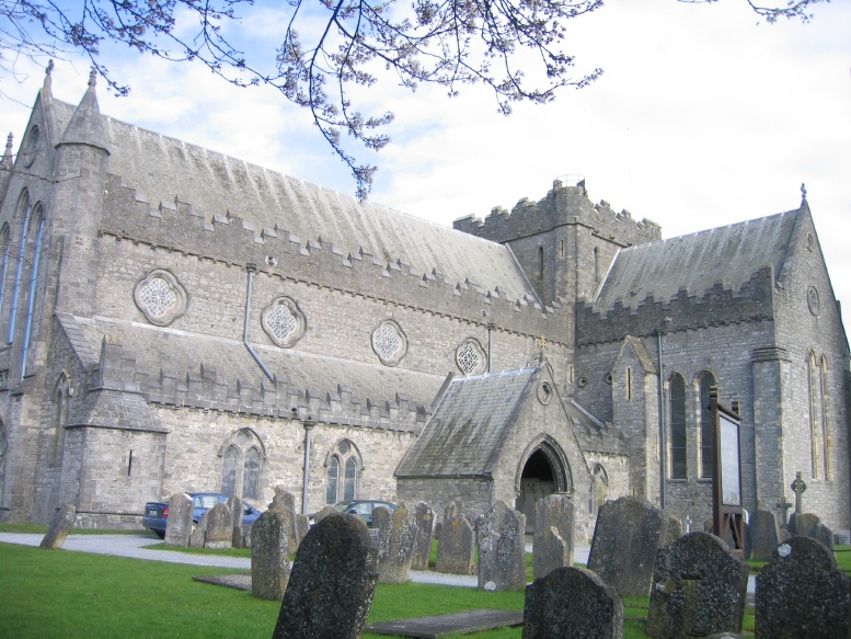
Jerpoint Abbey, located on the N9, 2 kilometres south of Thomastown, Kilkenny County. |
|
|
|
|
|
|
|
|

|
|
|
|
Jerpoint Abbey, a tomb inside the Church. |
|
|
|
|
|
|
|
|
|
|
|
|
|
|
|
|
|


 in the British Isles. A very cold windy day!")


 tower, Wexford town.")